
Georeferencing tus duab nrog AutoCAD
Nyob rau hauv lwm tus ncej peb tham txog georeferencing scanned maps los yog Google Earth dluab, peb pom yuav ua li cas ua nws nrog Manifold y nrog Microstation, hauv cov ntaub ntawv no koj tuaj yeem pom ntau cov ntsiab lus ntawm yuav ua li cas thiaj li tau txais Google daim duab ntawm lub ntiaj teb, qhov chaw khiav hauj lwm thiab kev txiav lawv li cas.
Tam sim no wb pom li cas georeference daim duab nrog AutoCAD
1. Nkag mus rau ib qho chaw
Yuav kom nkag mus rau hauv UTM qhov chaw hauv AutoCAD, nws yog ua raws li cov lus taw qhia. (Kos duab / taw tes / ntau kis)
tom qab ntawd nkag mus rau ib qho chaw hauv daim ntawv no:
los ntawm qhov hais kom ua bar yuav:
taw tes, nkag mus, koom tes, nkag, tswj, nkag ... kom txog thaum koj nkag rau lawv txhua.
Lub hom phiaj yog: "coordinate x", "coordinate y", ces lawv yuav
431512,1597077
431838,1597077
431511,1596838
431837,1596838
Yog hais tias lub kaw lus tsis txais lawv, nws yuav yog vim qhov kev tswj ntawm cov ntsiab lus tswj tsis yog raws li hom ntawv, yog li sau rau ntawm kab hais kom ua PDMODE = 2
Yog tias koj tsis pom lub cim lossis lawv zoo li me me, xaiv cov kab / qhov pom / thiab xaiv hom ntawv pom ntxiv.
Koj tuaj yeem tau ntshuam los ntawm excel
Nkag mus rau cov ntsiab lus yuav tsum zoo li qhov no:

Tam sim no peb yuav tsum ua li cas yog ntxig cov duab, qhov no yog ua tiav nrog "insert / image manager"

Peb nyem rau ntawm lub pob "xa", tom qab ntawd cov duab tau tshawb nrhiav thiab koj qhia tias qhov taw qhia nkag thiab teev yuav qhib nws ntawm qhov screen.
Tom qab ntawd xaiv lub ces kaum sab laug, nrog tus kis ntawm lub taw tes, thiab qis txoj cai.
Npaj txhij, daim duab yog georeferenced rau cov kev tswj kev tswjhwm.
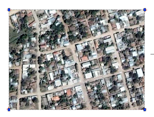
2 Yuav ua li cas yog Google Earth cov ntaub ntawv rau cadastre?
Tsis txhob siv qhov no rau kev ua haujlwm loj, vim tias qhov ntawd tsis yog GoogleEarth cov ntaub ntawv. Yav dhau los peb tau tham txog lubprecisions” uas muaj cov ntaub ntawv Google Earth.


Ua tsaug rau cov ntaub ntawv Cardinal. Nthuav heev
TSEEM MUAJ LAG LUAM
Kuv pom cov khoom siv rau georeference dluab hauv AutoCad uas muaj lawv cov ntaub ntawv "world" sib xws:
GeoRefImg cov Kev Hloov Tawm Tshiab georeferenced raster cov duab ncaj qha raws li lawv cov ntaub ntawv hauv ntiaj teb (VLX rau AutoCAD 2004/2005/2006, 2007/2008 thiab ADT)
http://www.cadstudio.cz/en/download.asp?file=GeoRefImg
Nyob zoo! Ua tsaug ntau ntau! Koj tsis paub li cas kuv txaus siab rau nws.
Txais tos!
Kuv tuaj los Ruth, mus ntes cov duab muaj qee cov cuab yeej thiab kuj koj tuaj yeem ua rau cov tawv dawb printscreen kos cov ncej.
mus ntes hauv mosaic
con Arc2earth
con AutoCAD
kuj nyob rau hauv cov ncej no kuv hais raws li yuav tsum tau georeferenced nyob hauv aggis
thiab saum toj no tag nrho kuv xav tias koj pom tus ncej ntawm cov ncauj lus tseem ceeb qhov muaj ntau txoj hauv kev mus download, upload thiab georeference
Nyob zoo ... .. thiab koj puas paub yuav ua li cas nqa cov duab ntawd los ntawm GoogleEarth thiab georeference nws hauv ARcGis? Koj yuav tau txais kev pab zoo yog koj muab rau kuv.
txais tos
Nyob zoo, ua tsaug, nws yog ib qho pab tau heev.